Water level
Live reading at the Wolfsmünster gauge, the flood alert levels explained - and the 2003 century flood in pictures.
The river right now
As of: 02.07.2026, 15:00 · Gauge Wolfsmünster (Nr. 24409003)
Reading the river
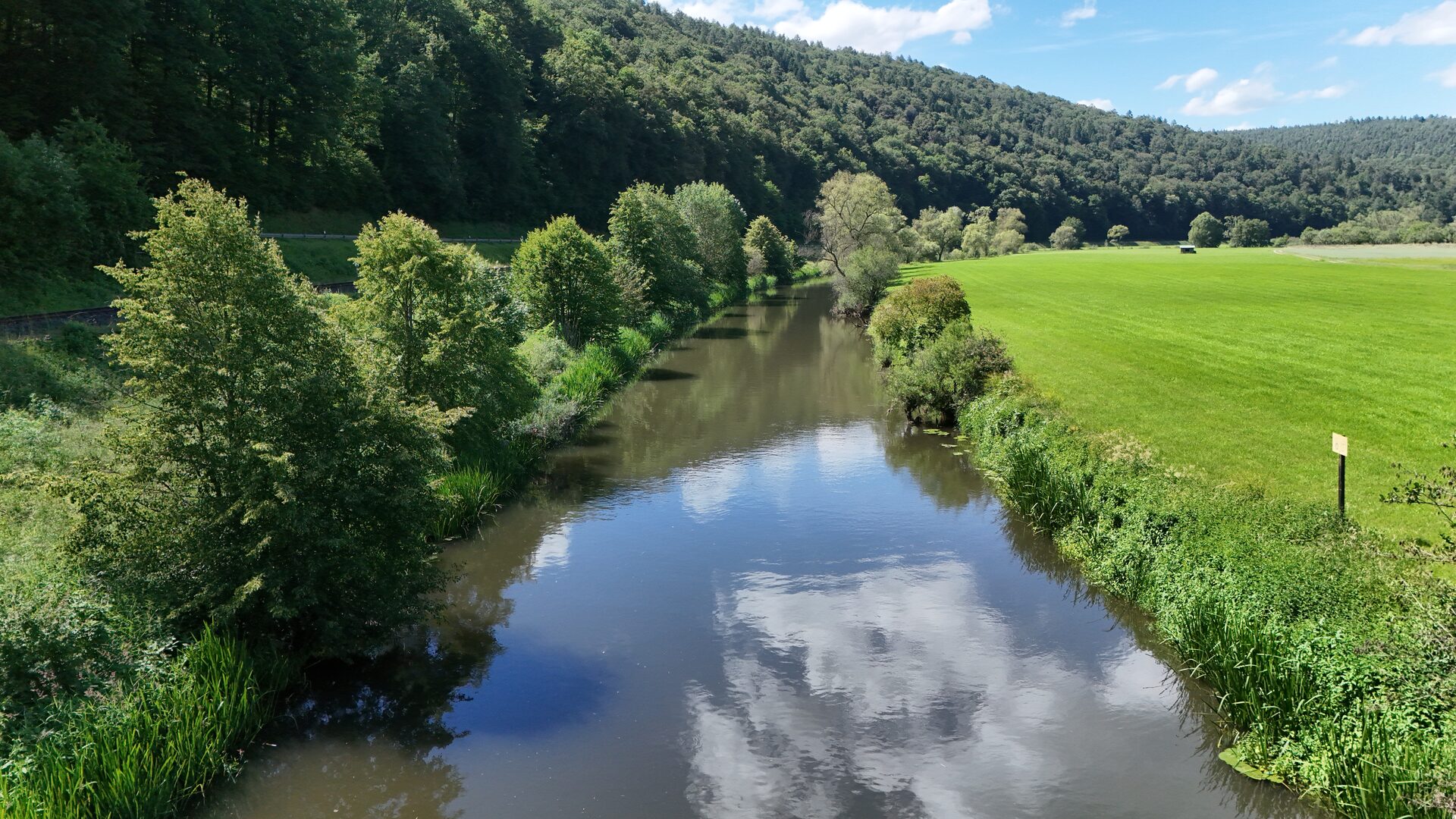
The mean discharge at Wolfsmünster is roughly 16 m³/s. Markedly higher, turbid water makes fishing harder and can be dangerous; clear water around or below the mean is usually pleasant. The gauge drains a catchment of about 2,126 km² and sits at river-km 6.9, just above the mouth into the Main.
The staff shows these thresholds as coloured zones - and, at the very top, the mark of the 2003 century flood.
No guarantee and not a flood warning. For official alerts and forecasts always refer to the Bavarian flood information service (HND).
Flood alert levels
-
Alert level 1 · from 330 cm First overflows and minor flooding.
-
Alert level 2 · from 370 cm Isolated flooded farmland and forest, occasional traffic disruption.
-
Alert level 3 · from 410 cm Flooded built-up areas and through-roads.
-
Alert level 4 · from 500 cm Large-scale flooding with the risk of major damage.
What floods at which level
-
370cm
Gräfendorf Village streets and the through-road are flooded. = alert level 2
-
380cm
State road near Wolfsmünster The carriageway is flooded. above alert level 2
-
460cm
Gemünden The Saale island is flooded. above alert level 3
-
600cm
State road 2302 Partly flooded between Schönau and Gemünden. above alert level 4
Local flood marks at the Wolfsmünster gauge · source: HND Bavaria.
The Wolfsmünster gauge at a glance
Location
- Watercourse
- Franconian Saale · river-km 6.90
- Municipality
- Gräfendorf
- District
- Main-Spessart
- Catchment
- 2.125,70 km²
- Gauge datum
- 155,35 m NHN (DHHN2016)
- Coordinates
- 50,0875° N · 9,7353° E
Operation & contact
- Gauge no.
- 24409003
- Telemetry
- yes
- Alert levels
- 330 · 370 · 410 · 500 cm
- Phone service
- 01804-370037-640 (0.20 €/call, German landline)
When the Saale broke its banks
On 3 January 2003 the Franconian Saale reached 650 cm at the Wolfsmünster gauge - the highest level ever recorded there, far above alert level 4 (500 cm). But the number is only half the story.
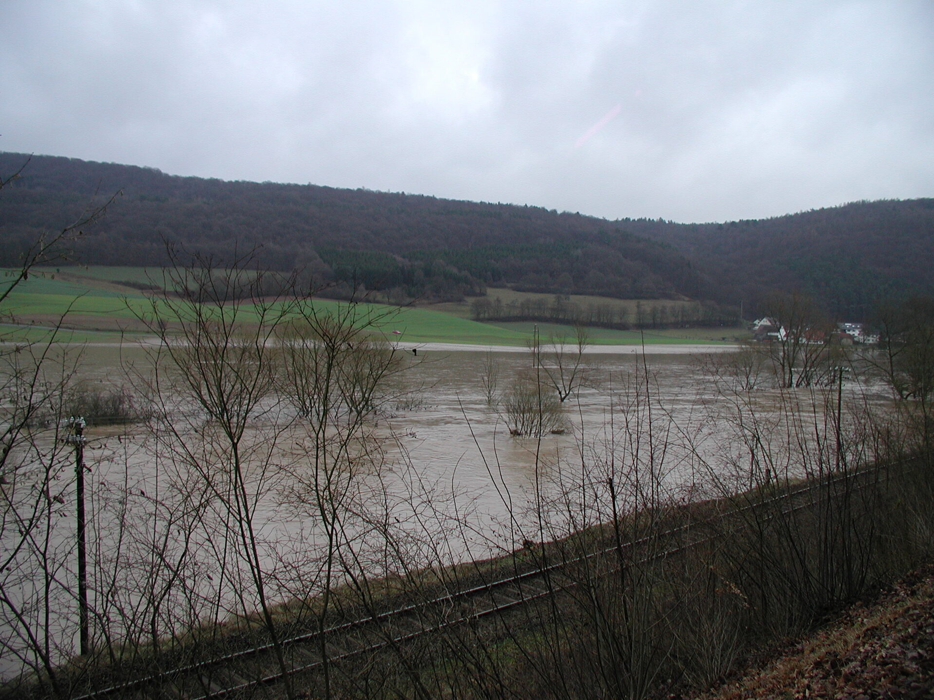
In the first days of January 2003 prolonged winter rain made the Franconian Saale rise fast and steep - typical of its winter floods, whose waves have a pronounced peak. Gräfendorf was the worst-hit municipality in the district; only a few centimetres spared its centre. What follows is reconstructed entirely from the contemporary reporting of the Main-Post (2000-2011): the chronology, the damage, the protection measures - and the words of the man at the heart of it, long-serving mayor Adolf Lutz.
Gauge figures (650 cm, 440 m³/s, the rankings): official HND Bavaria measurements.
Chronicle, damage, measures and quotes: documented in the contemporary press (sources at the end).
The highest floods on record
Water level
5 highest · 1973-2023
- 650 cm 03.01.2003
- 614 cm 14.01.2011
- 582 cm 24.01.1995
- 576 cm 08.02.1984
- 572 cm 06.01.1982
Discharge
5 highest · 1931-2021
- 440 m³/s 03.01.2003
- 354 m³/s 14.01.2011
- 351 m³/s 21.03.1940
- 325 m³/s 23.02.1970
- 317 m³/s 06.01.1982
2003 leads both lists - 440 m³/s is about 27× the mean. Official HND Bavaria series, Wolfsmünster gauge.
From a known danger to a flood-safe valley
-
2000
Dispute over the “big solution”
After the Wolfsmünster Saale bridge is closed, mayor Lutz demands a flood-free road instead of patchwork; the “Igus” citizens’ initiative keeps up the pressure.
-
2001
The Saale regains its meander
Near Gräfendorf a meander once cut off for log-driving is reopened - about 20,000 m³ of spoil, 340,000 marks - serving as a retention space too.
-
2002
Hauling the ferry out four times
In 2002 alone the fire brigade has to pull the Roßmühle ferry from the current four times; the struggle over a flood-free access road drags on.
-
2-3 January
First the Schondra, then the Saale
Persistent rain first sends the Schondra rising (it flowed “almost into the church”), then the Saale - far higher than anyone expected.
-
3/4 January
The peak - Gräfendorf at its limit
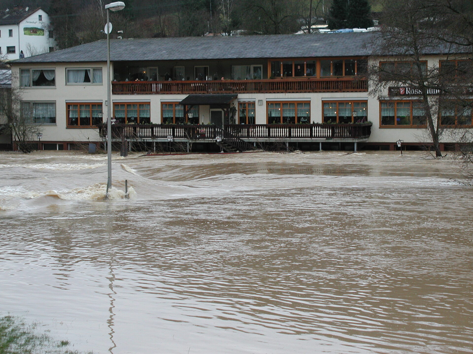
Gräfendorf is the worst-hit municipality in the district; only “a few centimetres” spare it the worst. Official peak: 650 cm (HND).
-
6 January
A cautious all-clear
Levels on the Main, Sinn and Saale fall; Gemünden gets off “with a black eye.”
-
9 January
A plea to the minister
Lutz writes to environment minister Schnappauf: about €1.1m of damage in Gräfendorf alone - asking for equal treatment and aid.
-
29-31 January
Consequences in the council
The council resolves a crisis unit, a “measures by water level” catalogue, a boat and sandbags; state aid comes with high hurdles.
-
March 2003
First Thulba-Saale conference
Sixteen mayors and conservation groups sign a resolution for future flood protection on the Saale and Thulba.
-
January 2004
A four-stage alarm plan
The Gräfendorf fire brigade unveils a flood-alarm plan keyed to the Bad Kissingen gauge and applies for its own Schondra gauge.
-
February 2005
Second Thulba-Saale conference
The water management office presents dam-building priorities, retention basins and a climate-change safety margin.
-
May 2005
An appeal to Stoiber
Lutz turns to premier Stoiber: the almost yearly flooded through-road is “the worst state road in Bavaria” - with eight photos of the damage.
-
September 2005
Dry into the Saale valley at last
The flood-free access road near Wolfsmünster is built - safe up to an 80-year flood. A “decades-old wish” comes true.
Damage across the valley
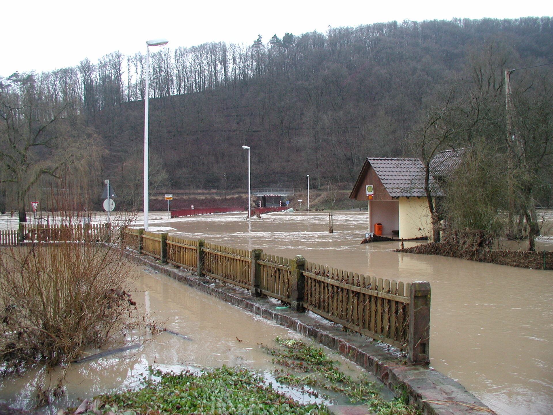
There were no casualties - rescuing the animals came first. The material damage, though, ran into the millions; Gräfendorf was hit hardest at around 1.1 million euros.
- Gräfendorf The whole village centre stood under water; together with Wolfsmünster about 50 cellars were flooded. about €1.1m
- Weickersgrüben · Roßmühle Inn and holiday flats wrecked; the ferry sank and the footbridge was destroyed. about €400,000
- Wolfsmünster The village was “cut off from the world” - no help could reach it from outside.
- Obersinn On Sinnstraße the corner of a house collapsed; 30 to 40 cellars filled and the Sinn footbridge buckled.
- Hofstetten · ASV clubhouse A 1.5 m level difference lifted the cellar floor - the whole building risked warping.
- Rieneck Persistent rain triggered a 60-70 m³ landslip at the Rotenberg; the Schellhof was inundated.
Adolf Lutz, in his own words
Mayor of Gräfendorf for eighteen years (1990-2008), Adolf Lutz was the steady voice for a flood-safe Saale valley. His words, verbatim from the reporting:
„Das ganze Dorf im Ortskern ist unter Wasser.“
“The whole village centre is under water.”
Adolf Lutz on the first day of the flood · 3 January 2003
-
„Sofort eine richtige Lösung machen, alles andere ist nur Flickwerk.“
“Make a proper solution right away - anything else is just patchwork.”
21 Jan 2000 · on the closed Wolfsmünster bridge
-
„Wir können nicht nur von einer Ortsumgehung von Wolfsmünster sprechen, sondern vielmehr von einer hochwasserfreien Zufahrt für das gesamte Saaletal.“
“This isn’t just a Wolfsmünster bypass - it’s a flood-free access road for the whole Saale valley.”
11 Jun 2002 · on the flood-free access road
-
„Auch der pausenlose Einsatz unserer Freiwilligen Feuerwehren und vieler Bürger konnte nicht verhindern, dass immenser Schaden entstand.“
“Even the tireless work of our volunteer fire brigades and many residents could not prevent immense damage.”
9 Jan 2003 · from the plea to minister Schnappauf
-
„Dieser Abschnitt wird fast jährlich vom Hochwasser überflutet und ist die einzige Durchgangsstraße im Saaletal.“
“This stretch floods almost every year and is the only through-road in the Saale valley.”
2 May 2005 · from the appeal to premier Stoiber
-
„Der jetzige Zustand ist ein totales Provisorium und keine Lösung.“
“The way it is now is a complete stopgap, not a solution.”
26 Jul 2005 · on rebuilding the Schondra footbridge
-
„Das Flurbereinigungsverfahren Wolfsmünster gab die Chance, den Jahrzehnte alten Wunsch zu erfüllen.“
“The Wolfsmünster land consolidation gave us the chance to fulfil a decades-old wish.”
23 Sep 2005 · on the finished flood-free access road
What was done to protect the valley
Renaturation, dams and basins, better forecasting - and above all a flood-free road. The measures the reporting records, with their status at the time.
Rivers & renaturation
Slow the river rather than just wall it in.
- Gräfendorf Saale meander reopened~20,000 m³ of spoil; also a retention space built
- Near-natural river design & tillageSlowing run-off out in the landscape called for
- River loops Hammelburg-UntereschenbachRetention in the upper Saale planned
Engineered defences
Dams, basins and a model for the whole catchment.
- Burgsinn flood channel, raised 30 cmHeld in 2003 - “maxed out but not overtopped” built
- Retention basins from 60 sites screenedAbout 20 deemed feasible planned
- Dam priorities + 15% climate marginBad Kissingen first planned
- Run-off model (2,765 km² catchment)Computes the effect of defences, €500,000 in place
Forecasting, alarm & organisation
Warn earlier, act faster, coordinate across boundaries.
- Four-stage flood alarm planKeyed to the Bad Kissingen gauge (~12 h lead) presented
- Crisis unit & “measures by water level”Coordination point in the town hall resolved
- Boat, pump, 2,000 sandbags, wadersKept ready at the municipal yard procured
- Own Schondra gauge requestedThe Schondra rises especially fast applied for
- Thulba-Saale conferences & resolutionSixteen mayors coordinate held
Flood-free access & roads
The Saale valley was never to be cut off again.
- Flood-free access road, WolfsmünsterSafe up to an 80-year flood built
- Raising the through-road St 2302Up to 2 m higher, “out of the flood” planned
- Schondra footbridge to a 50-year levelRaise it and link it to the cycle path resolved
- Appeal to premier StoiberEight damage photos, “worst state road” appeal
Sources — key Main-Post articles
This account draws solely on the contemporary reporting of the Main-Post (2000-2011); every figure and quote is documented there. A selection:
- Breite Front gegen „Flickwerk“ 21.01.2000
- Das Unglück kam im Schlaf 03.01.2003
- Lutz schreibt Bittbrief an Minister 09.01.2003
- Beim nächsten Mal besser gewappnet 10.01.2003
- Hohe Hürden für Finanzhilfe 31.01.2003
- Jeder kleinste Tropfen zählt 24.03.2003
- Höhere Rekordmarken durchaus denkbar 17.02.2005
- Lutz' Hilferuf an Stoiber 02.05.2005
- Einen Herzenswunsch erfüllt 23.09.2005
- Adolf Lutz unerwartet gestorben 02.11.2016
-
-
-
-
-
-
-
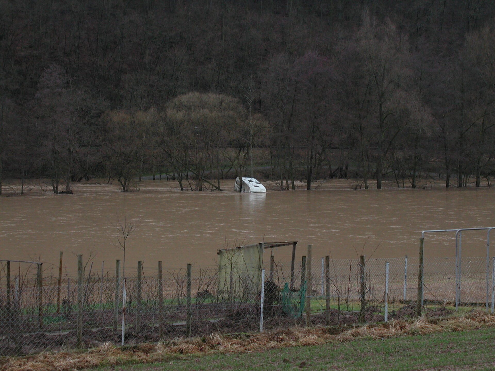
Klein-Hawaii lies in a bend of the Saale between Wolfsmünster and Schonderfeld - visible at the far right of the second photo. During floods the peninsula used to be completely cut off from the outside world, living up to its name; today a flood-proof access road off the side road keeps it reachable.
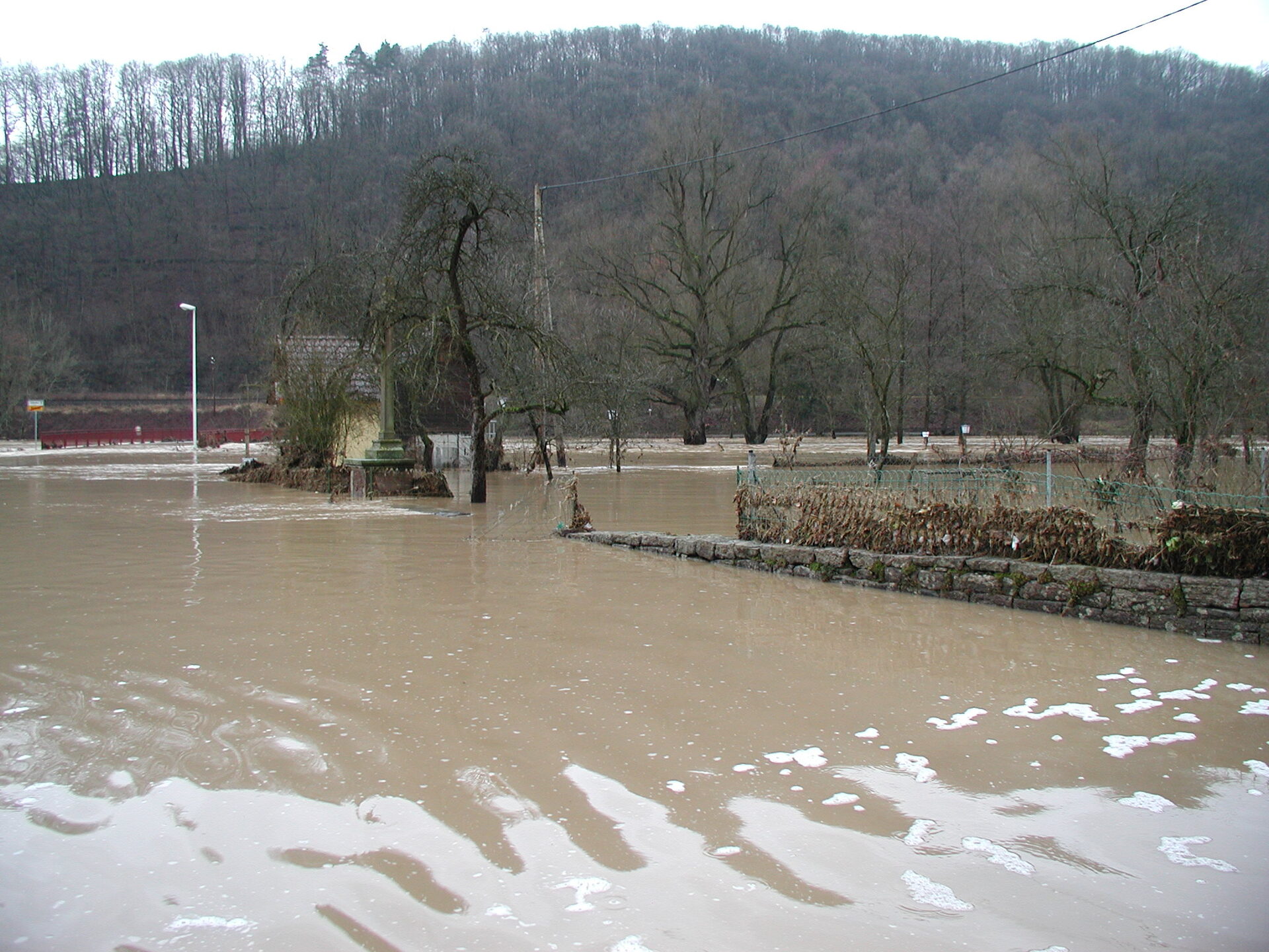
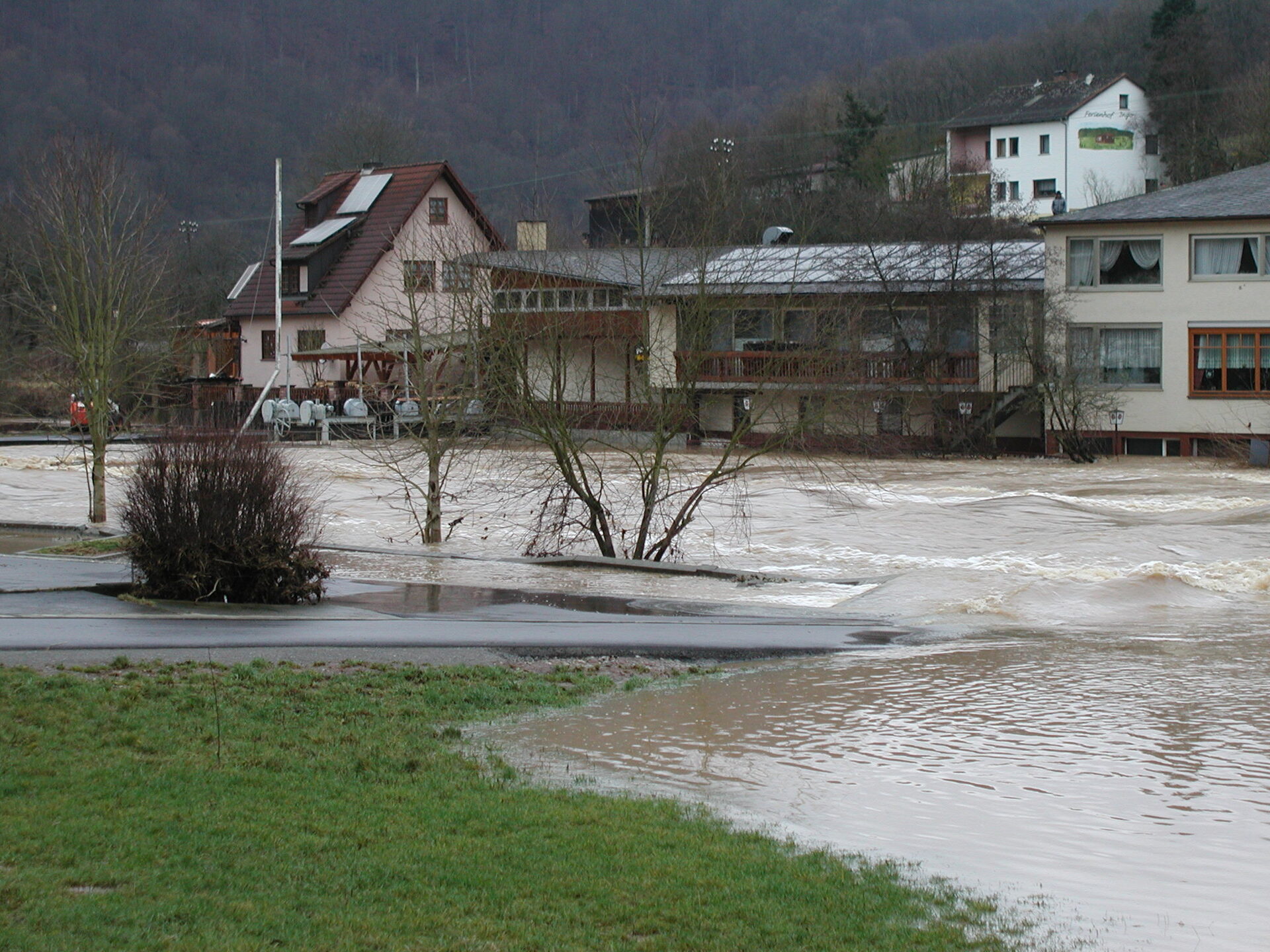
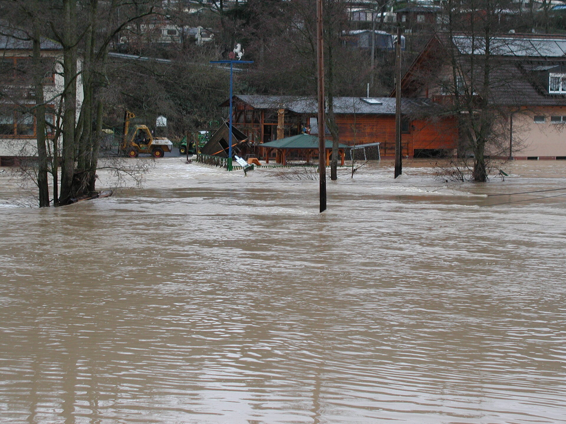
Photographs of the 2003 century flood: Adolf Josef Ludwig Lutz, former mayor of Gräfendorf - in remembrance.
Flooding on the Franconian Saale
From what level is there flooding on the Franconian Saale at Wolfsmünster?
At the Wolfsmünster gauge, flood reporting starts with alert level 1 at 330 cm. The further levels are 370 cm (level 2), 410 cm (level 3) and 500 cm (level 4). Below 330 cm there is no flooding in terms of the alert levels.
What do the four alert levels mean?
Level 1: first overflows and minor flooding. Level 2: isolated flooded farmland and forest and occasional traffic disruption. Level 3: flooded built-up areas and through-roads. Level 4: large-scale flooding with the risk of major damage. (Definitions of the Bavarian flood information service.)
Where can I find official flood warnings and forecasts?
Official warnings, forecasts and the gauge history are published by the Bavarian flood information service (HND) at hnd.bayern.de. The values on this page are for orientation only and are not a flood warning.
What was the 2003 century flood?
On 3 January 2003 the Franconian Saale reached 650 cm at the Wolfsmünster gauge - the highest level since records began and thus the namesake century event (alert level 4 is 500 cm). It was caused by prolonged winter rain and thaw. The photo series on this page documents it with images by Adolf Josef Ludwig Lutz.
How high was the highest discharge at Wolfsmünster?
The highest measured discharge at the Wolfsmünster gauge was 440 m³/s on 3 January 2003 - about 27 times the mean discharge of roughly 16 m³/s. It is followed by 354 m³/s (2011) and 351 m³/s (1940).
Who operates the Wolfsmünster gauge?
Gauge no. 24409003 is run by the Aschaffenburg Water Management Office. It sits at river-km 6.90 in the municipality of Gräfendorf (Main-Spessart district), with a gauge datum of 155.35 m above sea level (NHN) and a catchment of about 2,126 km².
Data source: Bavarian Environment Agency - Bavarian flood information service (hnd.bayern.de), licensed under CC BY 4.0. Provided without guarantee. Flood photographs: Adolf Josef Ludwig Lutz (CC BY-SA 4.0).